Using the USDA's Web Soil Survey interactive map helps provide a more thorough understanding of my study area. Although other research has shown similar findings, the extent to which detailed information was provided gave a clearer picture to the soil composition. I found the interactive map to be very user friendly, coming from someone with little background in soil knowledge. Below is a quick screenshot of my area of study depicting the land's soil make-up.

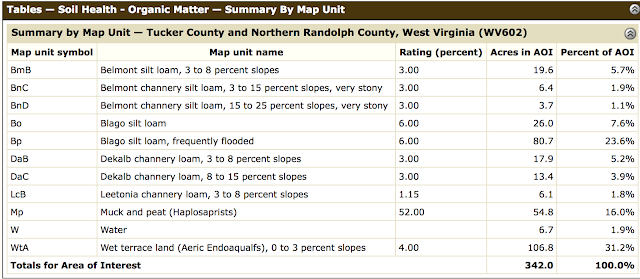
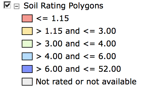
As you can see Blago silt loam, frequently flooded and Muck and Peat make up a majority of the study area. Essentially these soil compositions give identity to the area through the produced flora that thrives in the given composition. The colors making up the sections within the map are corresponding with the legend below.

I have selected "Soil Health Organic Matter", thus, this is what's being measured in this specific map.
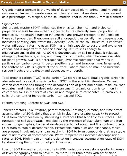
Another very useful feature within the interactive map is the option to "View Description". Once clicked, a window pops up and provides the user information of what is being measured and assessed. Although it is lengthy I'll show a partial screen shot for Soil Health Organic Matter.
Although this is my first time using this site, I found it user-friendly and very informative. I think there are many instances that would benefit from provided information. As mentioned from the youtube video, it is important to note for more accurate readings specific samples need to be conducted.

As you can see Blago silt loam, frequently flooded and Muck and Peat make up a majority of the study area. Essentially these soil compositions give identity to the area through the produced flora that thrives in the given composition. The colors making up the sections within the map are corresponding with the legend below.

I have selected "Soil Health Organic Matter", thus, this is what's being measured in this specific map.
Another very useful feature within the interactive map is the option to "View Description". Once clicked, a window pops up and provides the user information of what is being measured and assessed. Although it is lengthy I'll show a partial screen shot for Soil Health Organic Matter.

Although this is my first time using this site, I found it user-friendly and very informative. I think there are many instances that would benefit from provided information. As mentioned from the youtube video, it is important to note for more accurate readings specific samples need to be conducted.

Comments
Post a Comment